This summer’s devastating wildfires across Europe are putting firefighters under severe strain. Several Walloon companies are offering innovative solutions to prevent and more effectively combat these forest fires, which are unfortunately likely to become more frequent in the future. These solutions include space technologies, satellite data analysis and drones.
Starion, based in Libin, is leading the SAFEPLACE project, launched by the European Space Agency to strengthen environmental crisis management. This programme is developing a digital platform for Belgium, Spain and Luxembourg to provide emergency services and crisis managers with centralised, real-time information during disasters such as fires, floods, toxic spills and earthquakes.
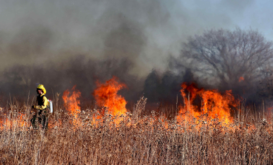
“The aim is to help the authorities manage crises more effectively using satellite and ground-based data. By combining these data sets, we can predict the risk of fire, but also anticipate how the fire will develop and spread, in real time,” explains Gaëtan Desclée, CEO of Starion. “Using satellite imagery, we can, for example, check that firebreaks are adequate in terms of vegetation width,” he adds.
Spacebel, an expert in Earth observation applications combined with AI technologies, joined the SAFEPLACE consortium in May 2026. The Liège-based company is developing a new fire risk mapping service that assesses the probability of a fire breaking out and vulnerability to fire in Belgium. Neighbouring regions in France, Germany, Luxembourg and the Netherlands could be included at a later stage.
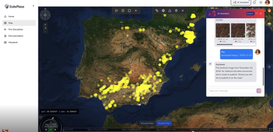
Image of SAFEPLACE platform © Starion
Since 2024, Spacebel has also been coordinating the SENWISE project, which is likewise funded by the European Space Agency and is due to be completed very soon. Together with the Liège Space Centre, the Walloon Centre for Agronomic Research and other European partners, notably in France, Spacebel is developing a solution for analysing vegetation imagery data.
By cross-referencing data from multiple parameters (soil type, humidity, vegetation, wind speed, etc.), SENWISE provides precise information on the areas most at risk of fire, which helps to identify the areas that need protecting. “In a second phase, it will also be able to predict the speed at which a fire spreads,” adds Romy Schlogel, the project’s initiator.
The SENWISE project also aims to optimise management practices in the fields of forestry and agriculture.
Also in Liège, ALX Systems – which specialises in drone development – has developed a prototype fire-fighting drone. Capsules are dropped over the affected areas. Upon impact with the ground, they deprive the fire of oxygen within a radius of around twenty metres. Although less effective than a Canadair aircraft, this technology does slow the spread of the flames, which could bolster the efforts of firefighters on the ground.
As well as fighting fires, drones can also play a role in prevention. ALX System is therefore developing surveillance drones, fitted with sensors, capable of detecting the first signs of a fire, raising the alarm and quickly triggering a targeted response on the ground.
Source: RTBF and l’Echo